These look as if they are going to cause a ‘disaster’ in lots of homes!!!

Here are our contributions from in class:

These look as if they are going to cause a ‘disaster’ in lots of homes!!!


Here are our contributions from in class:


In the first week of lockdown, we created world maps that showed the different climate zones of the world. In earthquake week, we added the location of all the tectonic plates to it. This week, volcano week, we have added the location of 5 infamous eruptions!
Here is Lewis W’s…he did a great job of making the volcanoes stand out from the map. Well done Lewis!

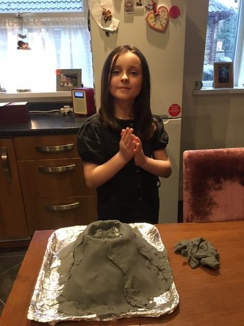
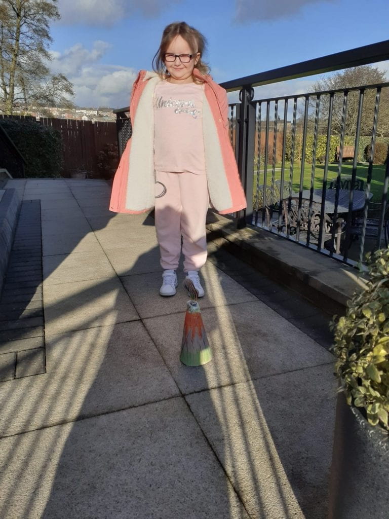
Lots of other children sent in volcano work too…


Lots of pupils sent in their diary entries. When you read them, check to see:


Jorja took several attempts to reach this masterpiece! She kept finding ways to strengthen and reinforce the structure. Well done Jorja! This is ace.

Check out this lovely design. That’s a pretty tall tower to say you used such slender materials and I understand that it passed all the tests…including you dancing around it like a lunatic! Well done!

Riley made this tough-looking castle to withstand an earthquake

Lewis used marshmallows to join his structure together. It looks fab AND passed all 3 tests. Well done!

Chloe was VERY frustrated building this masterpiece, BUT she didn’t give up! Great resilience Chloe. I love your choice of materials! I would say that earthquake you simulated would have topped the Richter scale too!!!
 (Video to follow)
This is a very solid looking structure from blocks. Check back soon becasue there are 2 great TEST videos that go with it!

This one made me laught a lot! The message that came with it says, “we tried, we failed, we had a lot of fun!” The pictures say it all really! Fantastic effort guys!

 😁👍Brilliant!!!
Don’t worry if you didn’t get your poster done in 1 afternoon, you can keep going back to it. I’d rather you take time with work and do your best than rush!
Here are some, work in progress to inspire you…
check out this super-sized mega poster! What a cool title and a lot of hard work!


Check out this hi-tech contribution! This pupil used photo shop to build up their title in layers to create this amazing effect!
And here is the finished article!


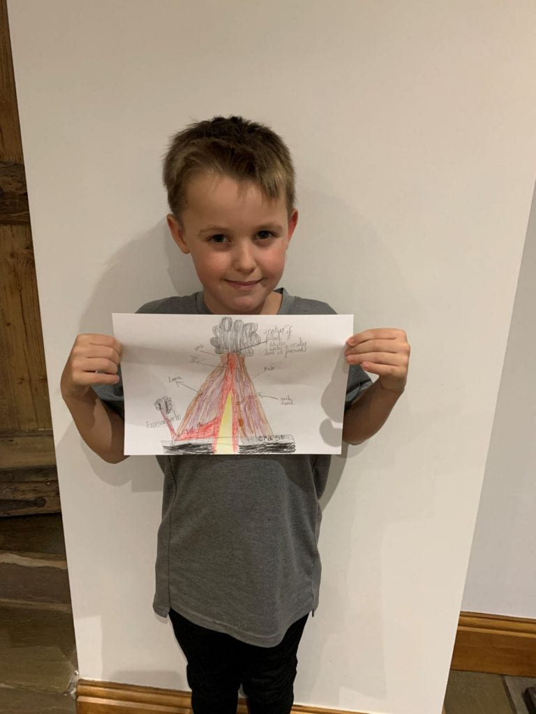
Frankie drew a cross-section of the Earth to show us what is going on beneath our feet!

Faith went for a very dramatic view of the Earth vibrating from all of the quakes! I like where you’ve put that scientists will ‘hopefully’ be able to predict them in future Faith!
[embeddoc url=”https://birdwellyear3.edublogs.org/files/2021/01/libby-EQ.docx” width=”40%” height=”200px” download=”all” viewer=”google” ]
Libby made her poster on word and filled it full of the facts she had learned during the afternoon! Well done Libby.
Can our teams use their knowledge of the Nile valley and their understanding of the water cycle to become museum curators and explain how it all works to you at home?


I’m sure you all guessed correctly that our class model was intact a replica of the journey that the river Nile takes through Egypt…obviously!!!
We are using the model to map out where geographical features of Egypt belong, such as the Red Sea, the deserts, the mountains, human settlements and the archeological sites like the pyramids. (They will be added as we cover them)


However, our model has also allowed us to examine and show how the water cycle works in Egypt…
1. Evaporation. The water is turned to vapour in the heat of the sun and rises up into the air

2. Condensation. The vapour cools & collects into clouds. As soon as the cooling vapour touches something solid (such as sand or dust particles in the air) In turns back into water

3. Precipitation. When the water gets too heavy for the clouds to hold, it falls back to Earth as rain. This tends to happen in cooler places such as mountains as the colder air makes more vapour condense.

4. The rain runs into valleys, streams and rivers where it returns to the sea so the whole cycle can start again.


Ask your child to tell you about the different parts of the cycle, use the photos and terminology to help. Try to encourage them to use the correct vocabulary:
Here is a couple of links to help you discuss it (See if you can make your mind out which narrator has the most annoying voice, I’m struggling to decide!)
…Don’t worry, we won’t blame you if you can’t tell just yet!


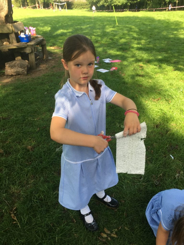
Year 3 are busy crafting something strange out of wood, card, tape and plaster! Can any of our grown ups guess what it is and leave their guess as a comment on here? (No cheating and asking your kids!)


We have been using Google Earth, maps and atlases in class as well as some old-fashioned maps of Egypt to look at what the country is like and where it is in the world. We have:
when we get home, ask us to find Egypt on a map. Also, ask us why all of the towns and cities in Ancient Egypt happened to be right next to the river Nile!


As part of our topic, we have used a range of maps and atlas. Next, we are going to see what Birdwell looks like from space using ariel photographs.
Can we use them to find our way around and describe what we can see? Are the photos and up to date representation of our village? Can we improve them?
Click the link to see BIRDWELL FROM SPACE…
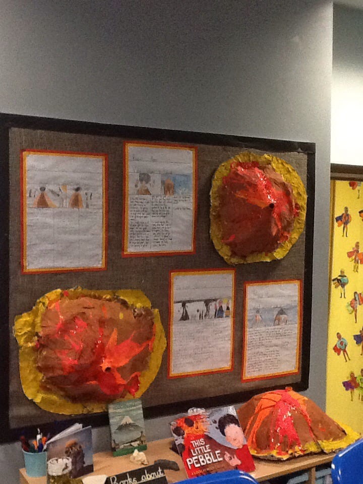
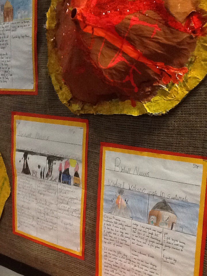
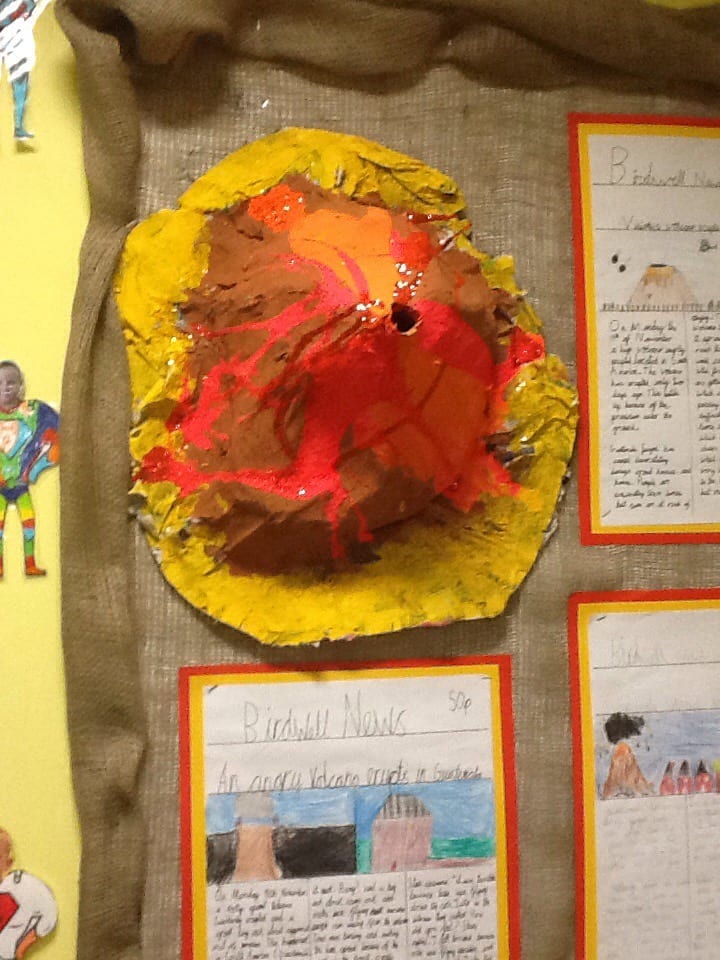
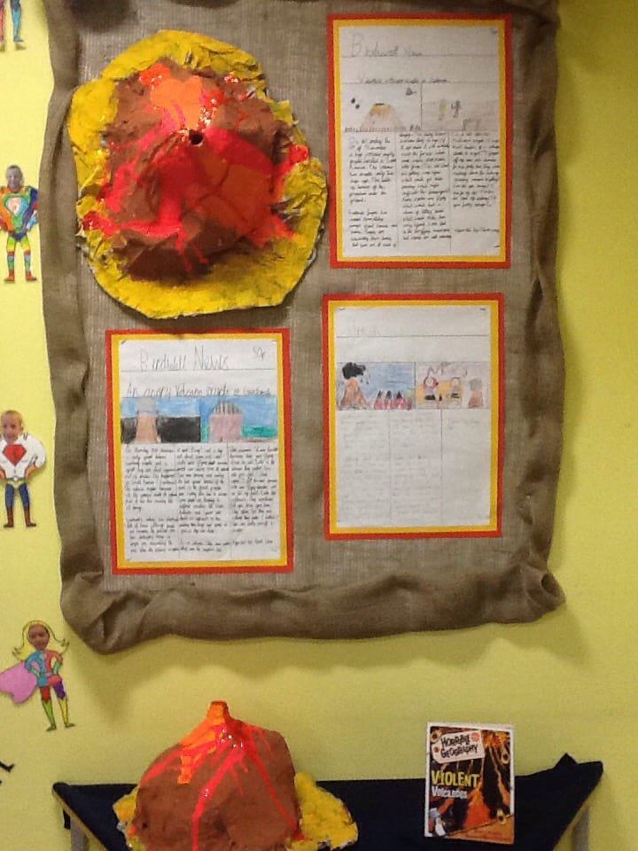
Come and take a look at the volcanoes we have made. We have also written newspaper articles about a recent eruption.

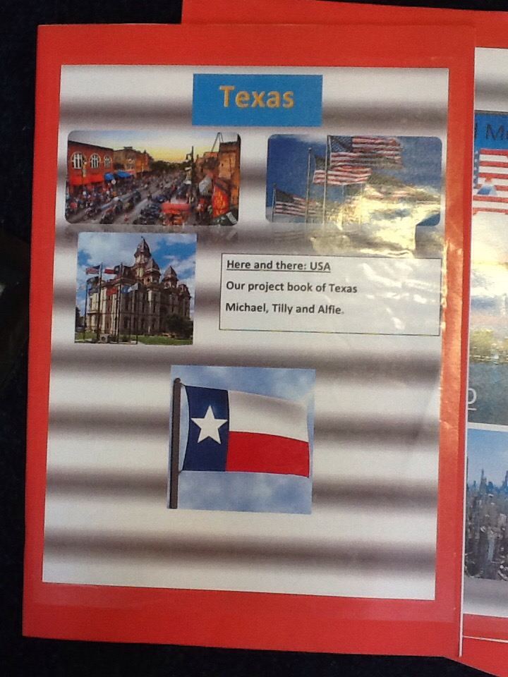
In class, we have started our brand new topic ‘USA’. We have created group topic books and will be showing why our state is the best!